What is Hawkeye : Manager ?
Hawkeye : Manager is a web-based project management tool for tracking your survey fleet, in a simple, user friendly format. Utilising the familiar mapping functionality of Google Maps, Hawkeye Manager allows the user to visually track the real time project progress, from planning to collection, right through to processing and verification.
With existing hardware already installed in your Hawkeye survey equipment and an internet connection, Hawkeye Manager not only tracks the location of your vehicles, but also provides real time status updates and survey verifications.
Managers can follow the progress of their survey fleet and monitor the quality of data collected. Using this information, any issues or bottlenecks can be quickly identified and corrected - all while the vehicle is still in the field.
Automatic Progress Tracking
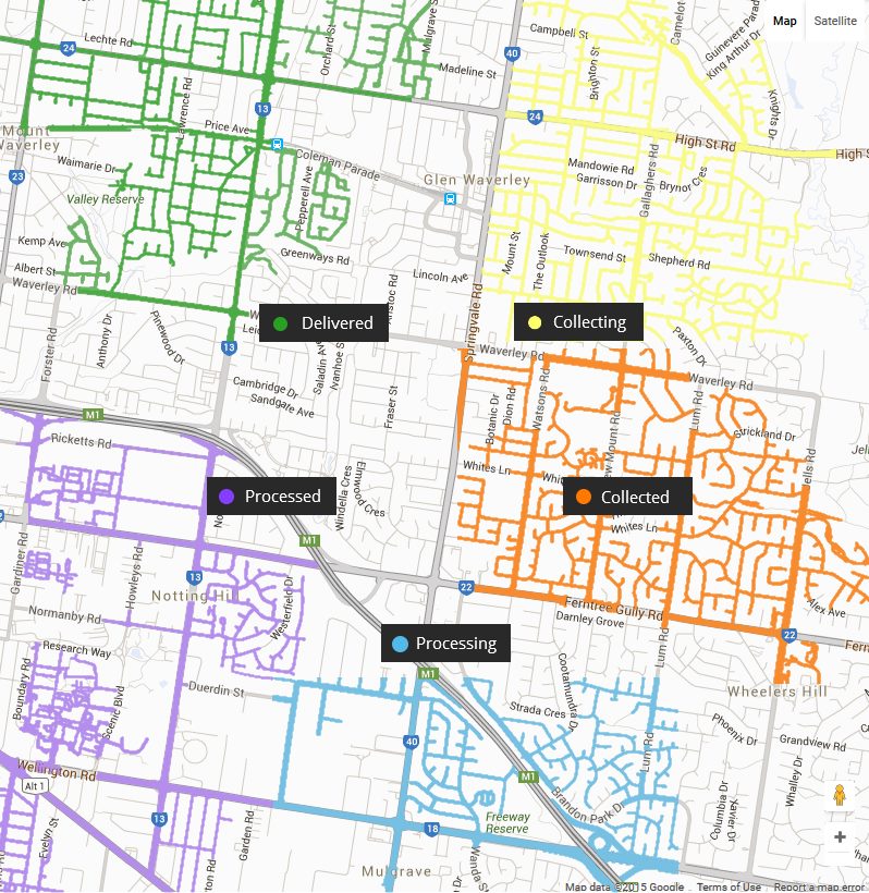
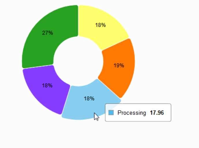
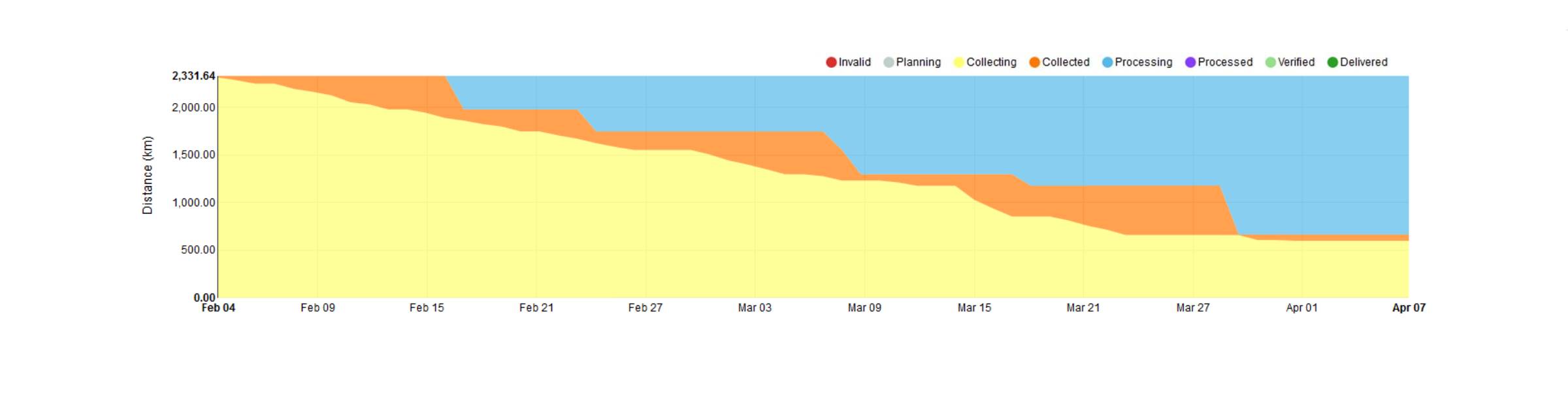
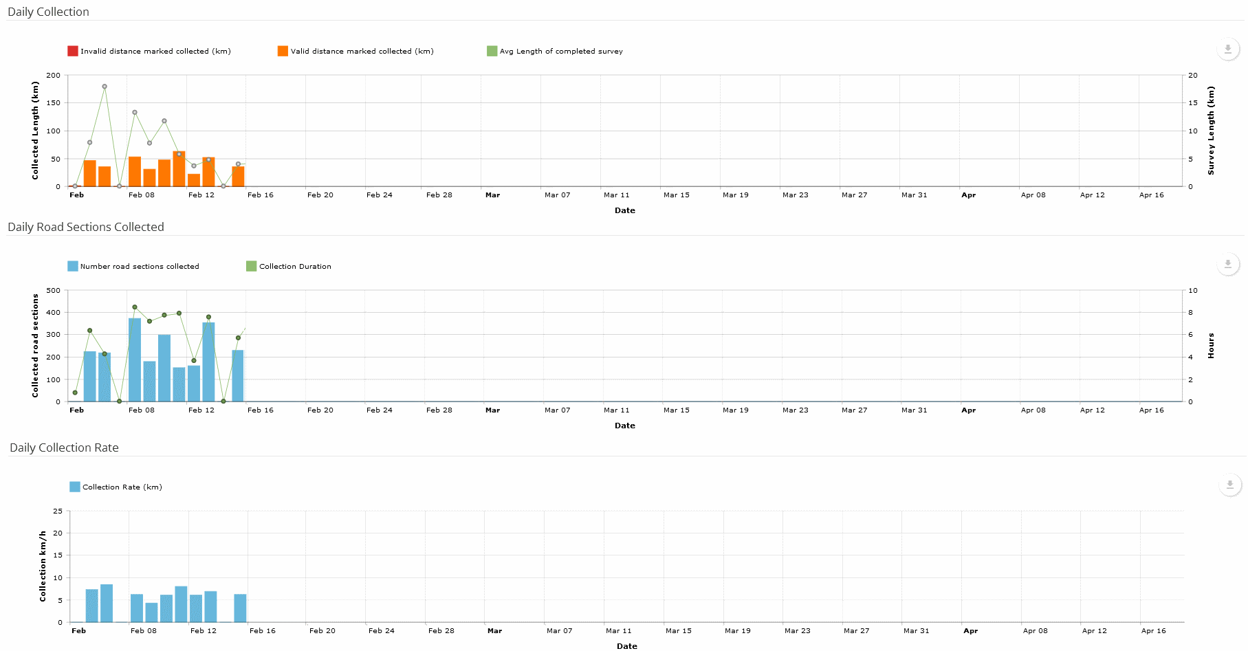
Each data collection project is tracked through multiple workflow stages. From the planning stages, through collection, processing, and delivery - your entire process can be monitored closely by multiple people within the organisation. Utilising GPS location, progress is automatically mapped spatially. Combined with more traditional reporting such as tables and pie charts, a high level overview is easily achieved.
In Depth Project Status
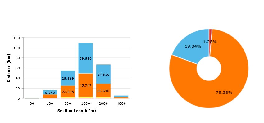
Pie charts, Binning of Section Lengths for Projects, and a Cumulative Flow Over Time Chart allows for the analysis of both the current project state but also a retrospective of project performance to identify bottlenecks in the workflow.
Understanding which parts of the network have been completed based on section length is also useful for predicting future speeds and collection types, which can help reduce operator stress.
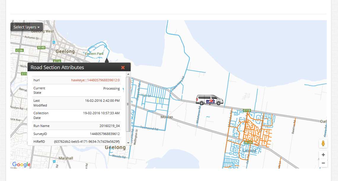
Realtime Vehicle Location
Vehicle location data is constantly streamed to the website, allowing for GPS information to be displayed along with the survey routes that have been collected and processed.
Multiple customised shapefile layers can be overlayed on the map to show additional features, while road section information is also made available for inspection, all in real time.
Survey Data Verification
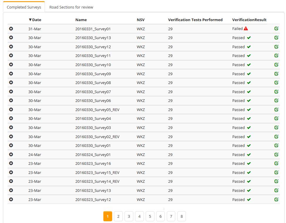
To minimize impact on project delivery, survey data is automatically analysed for correctness immediately after collection.
Failures can be reviewed by technical officers, and the data recollected, or accepted.
Customise test types for specific projects based on client needs and your quality requirements.
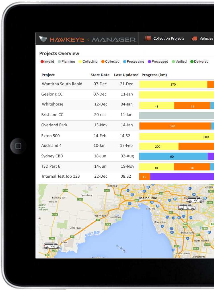
Projects Overview.
At a glance overview of all projects and statuses
Hawkeye : Insight Integration.
Use the same login details and seamlessly switch between Insight and Manager
Vehicle Tracking.
Realtime GPS location on maps
Workflow Analysis.
Automatic progress charts to identify bottlenecks
Vehicle Configuration Monitoring.
Review all vehicle settings, past and present, to ensure data accuracy
Auto Data Verification.
Data is automatically verified in vehicle, and results immediately shown on the website
Project Diary Notes.
Integrated communications between vehicle operators, and project managers
Automated Mapping.
Survey routes are analysed and your map automatically updated
Remote Troubleshooting.
Control any vehicle's settings, while still in your office

Let's Get In Touch!
For more information or to start using Hawkeye : Manager, please contact us.